

Summer, 2018
Design and Innovation
for Sustainable Cities (disc*)
UC Berkeley College of
Environmental Design,
Prof. Gabriel Kaprielian
San Rafael, California
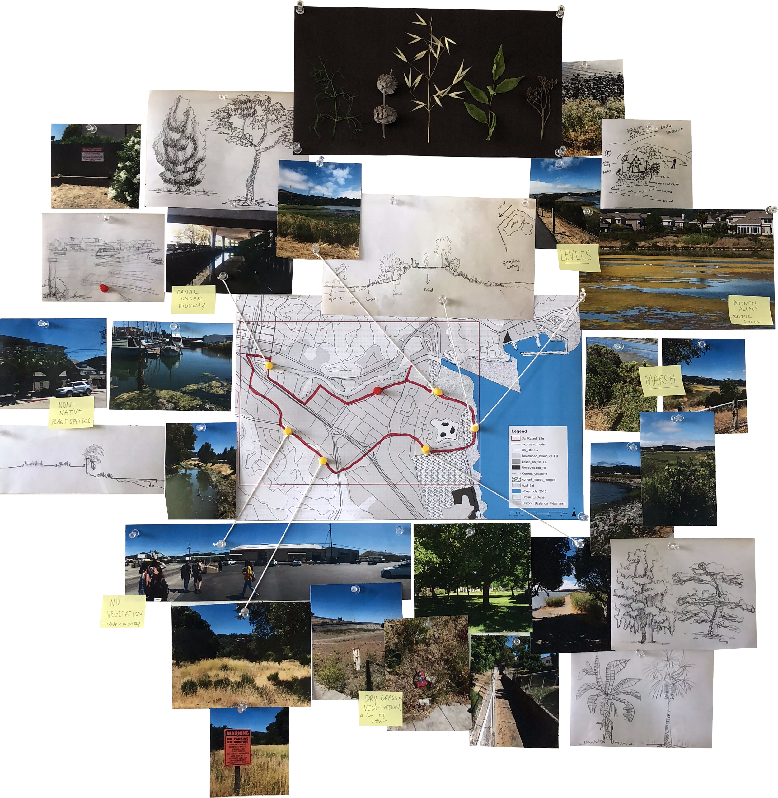
is in desperate need of innovative infrastructure in order to mitigate climate change.
Like many places abroad and here in the bay area, infrastructure and property are at risk to rising sea levels.
Large scale change that promotes the sustainability of infrastructure is crucial.
Solutions such as levees, coastal ecosystems, pushing property lines farther back from coasts, raised highways, and canals will need to be implemented.

The block morphology of San Rafael consists mainly of two story commercial and residential buildings.
Many of which having the potential of being converted to upper level living only. Effectively putting all the buildings on stilts.

The green space that does exist is abundant with plants and wild animals.
There is great potential for an ecological intervention.

San Rafael is not a very pedestrian friendly place. Bike lanes and ample walking paths are few and far between.
Most of the public green space is located along the water as well. Far from the inland commerce and industry areas.
There seems to be infinite combinations of interventions that could take place in an environment like San Rafael.
In order to determine the best solution, and to learn about how these different strategies can be applied elsewhere, a physical simulation board has been created.


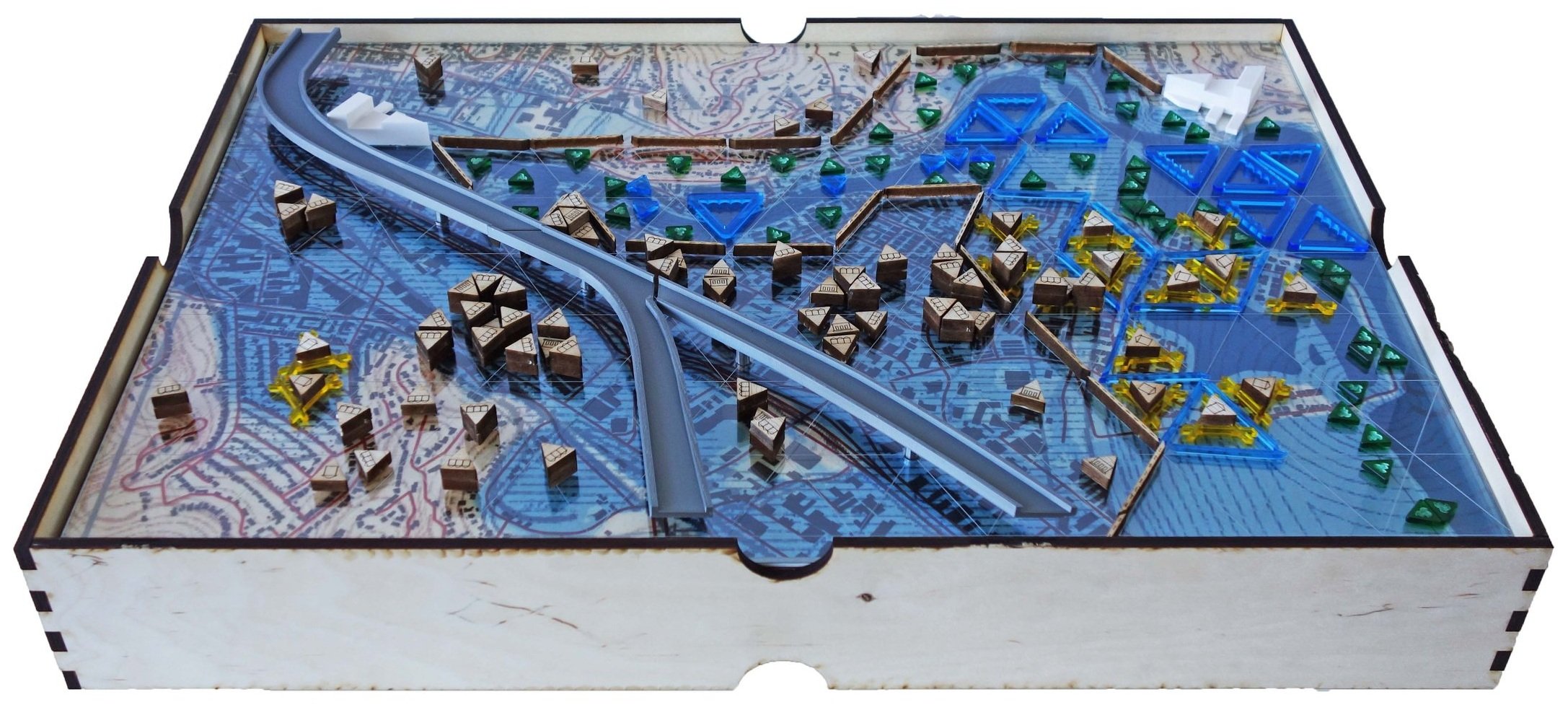


The simulation works in three different phases; 2 feet of sea level rise, 4 feet, and 6 feet.
A series of acrylic and wood pieces were laser cut to symbolize different forms such as canals, levees, vegetation, different heights of sea level rise and different types of property.

A number of cards to symbolize the different stakeholders at play were also incorporated into the simulation.
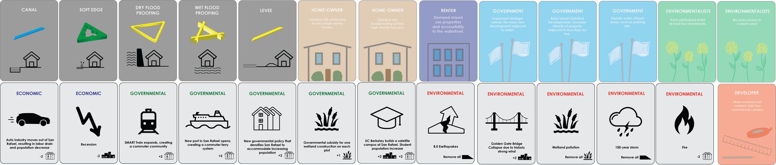


The entire simulation board is meant to be modular. So you can add and remove variables as you wish or play the game.

It was determined that a multi-phase solution is most probable. Employing different strategies as the water level is at different heights.
Phase 1 extends the existing canal. The dredged waster material is used to build the fortified road along the canal. An inter-modal transit center is introduced to accommodate boats, busses, and trains. The commercial area of San Rafael starts to be densified.

Phase 2 prepares the eastern part of San Rafael for flooding. The houses become elevated. The main highway has now been raised and enforced to embrace the flooding.

Phase 3 fortifies the roads to the west to withstand flooding. And the secondary canal beneath the raised highway is now flooded and used for transit. Also offering a place to commune along its banks.
